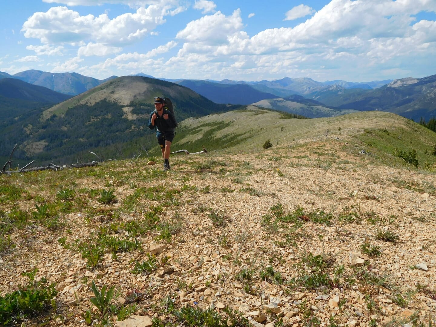
Among the triple crown hiking trails, the Continental Divide Trail, also known as the CDT, looms large. It’s the longest of the three (the other two being the Appalachian Trail and the Pacific Crest Trail), and the unofficial slogan of the CDT is “Embrace the Brutality.”
At 3,100 miles, including all possible alternates, its scope is only one of the distinguishing characteristics that set it apart from its National Scenic Trail siblings. Known for alternates that create a choose-your-own-adventure-style hike, colorful water sources (CDT also stands for the Cow Dung Trail), scrappy climbs, seemingly never-ending ridgelines, and expansive views at high altitudes, the CDT is a bucket-list long-distance hike that is truly unmatched anywhere else on the globe.
What Is the Continental Divide?
Also called the Great Divide, the Continental Divide is the ultimate hydrological divide of The Americas. It extends from the Bering Strait in northern Alaska (which separates the Pacific and Arctic oceans) all the way to the Strait of Magellan in southern Chile (which separates the Pacific and Atlantic oceans). The Continental Divide defines the watersheds that drain into the Pacific and Atlantic (and the Arctic). Rain that falls west of the Divide heads to the Pacific, while rain that falls to the east drains into the Atlantic.
The Continental Divide Trail follows this feature as closely as possible within its United States boundaries through Montana, Idaho, Wyoming, Colorado, and New Mexico.
A separate path extends north from where the CDT terminates at the U.S.-Canadian border to Kakwa Provincial Park.
CDT History
The history of American long trails as we know them today started with the formation of the Appalachian Trail Conference (now the Appalachian Trail Conservancy) in 1925. The AT was completed in 1937, which laid the groundwork for dreaming up and plotting more long trails for public exploration and enjoyment. The initial planning phase for the Pacific Crest Trail began around the completion of the Appalachian Trail, in the 1930s.
Fast forward to the 1960s, when members of the Rocky Mountain Trails Association were allegedly the first to begin hiking and plotting a route that would eventually become the Continental Divide Trail. In 1968 the National Trails System Act was passed and officially established the Appalachian Trail and the Pacific Crest Trails as the first two National Scenic Trails. The CDT was added to the roster of National Scenic trails in 1978.
But How Long Is the CDT, Really?
The number “3,100” is the most common mileage quoted for the total length of the CDT, whether you ask hikers who have walked it or consult the internet. It’s also the official mileage quoted by the Continental Divide Trail Coalition, the body that oversees the care and maintenance of the CDT.
Johnathan Ley, who creates the most detailed and commonly-used mapset for the CDT, has a main route of (details on Ley below) that comes in shorter at 2,800 total miles.
The CDT’s most common direction of travel is northbound, from Mexico to Canada, but the CDT is more seasonally suited for southbound hiking from Canada to Mexico. Southbound hikers generally start from late June through mid July, though that varies based on current seasonal weather conditions. Anyone hiking it should keep on top of Snotel reports on snowpack, along with avalanche conditions.
On a CDT south- or northbound hike, you need to plan on carrying microspikes and an ice axe for conditions in Montana and Colorado. Familiarize yourself with these tools and at least the basics for using them.
The CDT is mostly a trail for hikers and equestrians or pack animals, however some sections are open to biking and motorized use where the CDT shares tread with other trails and use areas.
Navigation and Maps for the CDT
Johnathan Ley created a complete set of annotated and highly entertaining printed maps starting after his own thru hike of the CDT in 2001. He updates the mapset annually based on hiker feedback, and produces the maps entirely for free. You can contact him directly for access to the maps at [email protected] for printable PDF files. Users are welcome to donate to Johnathan for his efforts via PayPal at the same email address.
Ley’s maps are also available for download via the free Avenza app, which displays your location using your phone’s GPS.
The other app-based option that uses GPS for navigational aid is called Far Out Guides. The app itself is free to download, but then you need to purchase the CDT guide from within Far Out after download. The CDT guide costs $49.99 for the entire trail. Make sure you make all the maps you need available for offline use before leaving WiFi or cell service. Don’t assume the downloads worked, however; be sure to confirm your maps are available offline by closing the app, putting your phone in airplane mode, then reopening the app and checking that the downloaded maps are still available to view in full resolution.
Water and Water Treatment
My method of choice for treating water is using an ultralight water filter and carrying chemical treatment as a backup. Water treatment is based on personal preference and you should do what you’ve already tested, are confident in using, and know works for you. I bring equipment for backflushing and it’s one of the town chores I’m religious about keeping on top of. As my filter’s flow rate slows between towns, I’ll catch myself getting too relaxed about staying hydrated. For me, backflushing is essential to staying safe and performing well (aka making miles) in the backcountry.
Read Next: Best Backpacking Water Filters
I find chemical treatments useful for several scenarios in particular:
- I haven’t been able to backflush my filter in quite a while, either due to opting out of a town stop, or not having access to potable water in town. Sometimes the inevitable happens and the flow rate becomes too low to justify all that squeezing during precious break or tent time.
- The water source in front of me is visibly full of matter, and even with a high flow rate filter in hand, just isn’t worth pushing through and destroying the flow rate for the rest of the section.
- There are known or suspected viruses in the water source. Remember that water filters don’t remove viruses from our water sources. I once got Norovirus that was known to be circulating among hikers in the area from a contaminated spring that I filtered from instead of chemically treating.
Resupply and Trail Towns
The CDTC offers a CDT Planning Guide PDF download that is available for a suggested donation of $10. Inside there are six full pages of suggested resupply locations to choose from.
To narrow those down, HalfwayAnywhere.com conducts an annual survey on most common/best resupply strategies (among their surveys on many other thru-hiker and long trail-centric topics)
Your individual resupply strategy will ultimately be a personal choice, perhaps one that will need to maintain a degree of adaptability and morph as your needs and desires change along the way. If you have allergies or other dietary restrictions, you may need to think more deeply about mailing yourself resupply boxes to accommodate your needs.
If you err on the side of having fewer restrictions, or enjoy the adventure of seeing what’s available in gas stations, general stores, and large box stores in the variable size towns along the trail, then a resupply-as-you-go strategy may be for you.
For most hikers, your personal strategy will likely be some hybrid of mailing yourself resupply boxes and buying as you go. Anywhere you choose to mail a box is your responsibility to personally call and confirm:
- The location is still accepting hiker resupply boxes. Also confirm how long they will hold your box, and what information they need written on the outside (such as name, ETA, etc.)
- The location’s address, and how it needs to be formatted to incorporate your name
- The location’s hours and days of operation. In rural and remote areas, many locations operate on limited hours, limited days per week, seasonally, and/or with few employees.
- Any fees. Most locations will hold a resupply package for free, but some charge a fee. You may want to inquire about this so that you can plan/budget accordingly.
Holding hiker resupply boxes is a service to the hiking community and we are grateful these establishments are willing to accommodate the unique needs of the thru-hiker.
Permits and Bureaucracy
The CDTC asks hikers, including but not limited to thru-hikers, to voluntarily register their CDT hike on their website. Registering is free, and signs you up for critical trail alerts (like closures, reroutes, fire information) and also qualifies you to receive a CDT hang tag, which must be picked up at select locations near the northern and southern terminuses. Registration does not replace use permits you need for certain jurisdictions along the CDT.
Permits
Several permits are required to thru-hike the continental divide trail. The permits below are ordered as if you are hiking north to south.
- Camping within Glacier National Park costs $7 per person per night. You can begin applying for permits on the park’s website March 15th of the year of your hike. You can also get your camping permits the day before (by phone or walk up) if you don’t want to be beholden to specific dates far in advance.
- A Blackfeet Nation Fish and Wildlife Recreation Permit is required for any recreation on the Blackfeet Reservation.
- Yellowstone National Park requires permits for backcountry camping that are $3 per person per night. Permits must be obtained no more than 48 hours before your trip and can be obtained at a variety of ranger stations and visitor’s centers.
- The CDT also briefly enters Rocky Mountain National Park and the Indian Peaks Wilderness. Both require backcountry camping permits which are avoided if you choose to simply hike through. Permits are not required for day use in these jurisdictions.
Weather on the CDT
Familiarize yourself with summer conditions in the Intermountain West (which includes all of the states along the Continental Divide), which has a weather pattern of frequent, if not daily, afternoon thunderstorms. Read your maps the day before, and prepare so you’re not hiking along exposed ridgelines or stopping at highpoints during afternoon hours. Continue to use your best judgment about your specific skill set and gear. Remember that hiking partners may have differing skills and comfort levels. Do not be afraid to think independently and advocate for yourself in your journey.
More on Alternates and Actual Mileage
A topic of debate in the hiking community is the actual mileage of the CDT. Why is this so complicated?
As mentioned above, the CDT is listed as anywhere from 2,700 to 3,150 miles, depending on the combination of alternates and official route you take on this trail that fully embraces a “choose your own adventure” style of hiking. The Continental Divide Trail Coalition itself says the trail totals 3,028 miles. The Far Out app, the most commonly used navigational app on the CDT, calls the trail 3,050 miles. My thru-hiking engineer friend, who is as giddy about collecting data as he is about walking, has conveyed his totals as 2,700 and 2,970 miles.
What It’s Like to Hike the Continental Divide Trail
When I started the CDT, I had a complex emotional cocktail brewing inside me. Two years earlier, I had kicked off my long distance hiking career with the PCT, and inadvertently fallen fully in love with the trail itself, and the thriving community of people and places the trail fosters. Going into it, I had no idea that community even existed. The year between the PCT and the CDT, I had experienced a deep, personal loss that I was certain I’d never fully return from. These two formative forces, both totally out of my control and completely outside of what I had envisioned for myself leading up to that point, ultimately put me on the path of choosing to hike the CDT, a re-working of my original plan to hike the Triple Crown of long distance trails in three consecutive years.
I started the CDT at the Chief Mountain Port of Entry on the U.S. side of the line. I had — totally coincidentally — run into three hikers I knew from the PCT two years earlier who all happened to be starting the same day as I was, all independently of each other. If it seems too unbelievable to be true, you haven’t yet ripped the packaging off a long trail and seen its sparkly underside. Coincidences like this happen almost daily, even many times each day in some instances, and this serendipity was kicking off a long line of “the trail providing,” as we long distance hikers say.
In Montana the group of us that had become a circumstantial trail family rolled along and gradually picked up other hikers: Quickham, Smokey, and finally Recon. The early days in the northern Rockies stretched out long before us following the summer solstice, and it wasn’t fully dark until 11pm. We took advantage, growing our trail legs gradually, enjoying long hours to complete our allotted mileage for the day. Lunch breaks lingered, fires at camp (normally a rare, if ever, event on a long trail) and our nightly group read-alouds of Louie L’Amour westerns went until midnight.
The banter between L’Amour characters quickly became our own, and as we walked through the Bob Marshall Wilderness, we would curse the blowdowns with shouts of “yellow-bellied” or an even more gratifying, “Damn it, Bobby.” (A reference to Bob Marshall; no offense, Bobby.)
By the time we had climbed the jungle gym of tree limbs across The Bob, it had won us over so much we spent the rest of the trail proclaiming: “I’d rather be straddling a blowdown,” as we zigzagged along the CDT.
Thru-hiking is a long game, and an endurance sport. I say that once I’ve reached my peak physical fitness again, or gotten my “trail legs” back, the miles take care of themselves. Maybe it’s not quite that simple — you’ll still need to mine for discipline and stamina each morning. The tent won’t break down itself, and unfortunately they still haven’t invented a pack that carries you. But the miles … they flow. I call it robot legs. On the CDT, I existing up in my mind, a floating head carried by a pair of legs that seem to move themselves, terrain flying by underfoot, earth, trees and sky all blended together in one seamless blur, myself a guest and one with it, all at once.
My mind can also be my greatest downfall in the frontcountry and backcountry worlds. Like other endurance sports, thru-hiking is a mental game. Fitness comes and the legs follow and the miles flow … sometimes. Other times, it’s like my mind wants to plant itself on a rock and pull my body slowly backward down the mountain. The most gorgeous sunset can land with utterly flat affect to the mind that’s gone rogue.
I try to be on my whole-body (physical, mental, emotional) A-game, but it’s easy to slip when you’re counting miles and digging cat holes every day. When I hear that internal monolog twist to self doubt, I turn to my inner nurturer rather than my internal whip cracker. Think more like a kind aunt baking cookies and less like a crazed circus trainer. My goal is not a death march; it’s a life dance.
I have taken well to hiking routes rather than established trails, and I revel in walking the direction opposite of most in order to absorb more solitude. But even I subscribe to the old adage: “It’s about the people.”
Read Next: A Beginner’s Guide to Thru-Hiking
My ironic truth is that while I go to the trails to get away (from frontcountry distractions, every day stressors, the drama of the world), what I find is a deeper knowing of myself and those I do encounter in the backcountry.
It’s the people of the CDT who will become your fondest memories, your highest highs, and your tribe for life.
To this day, the southbound CDT hikers of 2016 are some of my absolute dearest friends. They are the people I can be my most raw and honest with. They are the people I’ve had the honor of laughing with, crying with, climbing with, and straddling countless blowdowns alongside.
Read the full article here