America’s public-land champions are sitting on pins and needles today as the House of Representatives debates a budget proposal that would require the federal government to sell off huge chunks of those lands in Utah and Nevada. Hunters, anglers, and other public-land advocates have for days been hounding their representatives to remove the public land sales amendment from what House Republicans are calling the One Big, Beautiful Bill.
Now, thanks to a report released by onX Wednesday morning, public-land advocates are learning that the scale of public lands identified in this proposal is even worse — much worse — than initially thought. As the debate in the House dragged on today, onX announced that the federal acreage slated for disposal is roughly three times larger than the previous estimates, which were around 500,000 acres.
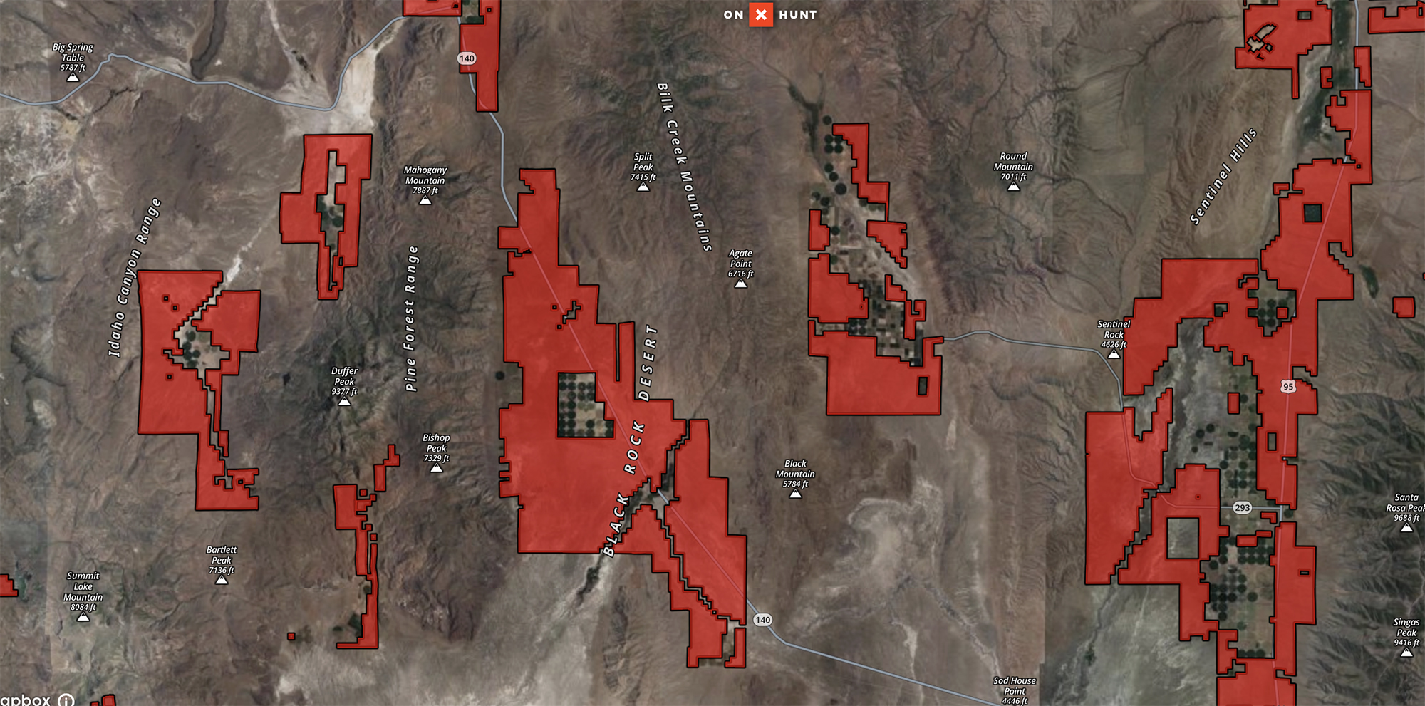
“onX’s GIS analysis reveals that nearly 1.5 million acres of public lands in Utah and Nevada are under threat — tripling previous estimates,” according to the report, which includes the first and only digital map of the lands being threatened, and which is embedded here:
According to onX, their “geospatial team started with a set of PDF maps specifically referenced in the legislative text showing federal lands that could be sold off. Some of these maps were already tied to real-world locations, which let us trace the parcels by hand. Some we had to manually align to real-world locations and then extract the parcel information. Others had embedded data that we could pull straight from the files. In one case, we were even given a full digital dataset. For a few larger areas that were only roughly outlined, we used our own onX parcel data to pinpoint exactly which federal lands were included.”
As we’ve previously reported, part of the reason this budget proposal is so problematic and ill-conceived is that it’s being done behind closed doors in late-night meetings, with none of the transparency or public input that has traditionally guided public land transfers in the U.S.
Ben Brettingen, hunt marketing manager for onX, says the mapping company’s GIS team has been digging into the public-land data since May 14. That’s when the team first saw maps based on the text of the amendment that was introduced late at night on May 6 by Reps. Celeste Maloi and Mark Amodei and pushed through the House Natural Resources Committee. Brettingen was turkey hunting in Wisconsin when he got a text from a colleague that included the raw maps.
“I just did a double take, and my blood ran cold,” Brettingen tells Outdoor Life. He’d recognized the maps from a chukar hunting trip he took to Nevada recently, and suddenly the amorphous policy proposal from D.C. became something real and recognizable. “It’s one of those things where these lands are not in [your] backyard, so you would never think that this stuff would impact you. And then, when it does, it hits you right in the gut.”
As Brettingen explains in a video highlighting the value of these public lands, he had heard about the controversial public land sales amendment earlier in May, and immediately pictured some Southwestern scrublands near gas stations and bordering interstates. Then he put two and two together.
Read Next: Here’s Why the Federal Land Sale Bill Is a Bad Idea, and Horrible Legislation
“These weren’t throwaway acres,” Brettingen says. “This is prime country. Places I know. Places I’ve bled and sweat and watched dogs lock up on rock outcroppings. And if these lands are considered disposable, what’s next? Because here’s the truth. They don’t always look like National Parks. There’s no paved road, no welcome sign. But to those who have climbed them, who’ve hunted them, they are sacred. And they’re irreplaceable … If they can dispose of this land, what’s stopping them from coming for yours?”
Read the full article here


